
Amherst Neighbors by Block
Block research in Amherst works best when each record has a narrow purpose. The public parcel map shows adjoining land and owner-card links. A property card adds assessment and parcel context. A local voter-list request can address public election fields, while a police log adds only street-level context. None of those sources proves every person at an address. Keep the distinction between the parcel owner, a tax mailing contact, and a resident in view from the first search.
| Source | What It Shows About a Block | Access |
|---|---|---|
| Amherst GIS parcel map | Adjacent parcel polygons, PIN, map, block, lot, owner-card links, and zoning, flood, or district context | Free public viewer with map browse and selection |
| Amherst Property Search | Owner, mailing and situs address, assessment, sales, and permit or violation history for a parcel | Free public address, owner, or parcel search |
| Hampshire deed index | Ownership succession for a selected parcel | Free online index; early book-and-page fallback |
| Amherst local voter list | Public registered-voter fields at listed addresses where allowed | Request from the Town Clerk; protected fields withheld |
| Amherst police weekly log | Non-sensitive calls by street name, without a street number | Online PDFs and archive |
| DONA and local civic groups | Public concerns, events, projects, and contacts | Public contact or meeting information; no member roster located |
| Jones and Historical Society resources | Historical directory occupants, newspapers, tax maps, and building-history context | Special Collections access and digitized resource links |
Ownership is not occupancy. Amherst property data can show an owner and an owner mailing address, but the mailing address may be outside the town or connected to a different parcel. A voter list, if lawfully obtained, has separate public-field rules. The public record layer does not reliably identify every current household member.
Amherst Parcel Cards Set Limits
Amherst Property Search accepts street and house-number selections in address mode, a last-name field in owner mode, and a parcel-ID field in parcel mode. A result can link to the parcel ID, address, property card, use description, recent assessments, sales history, permits, violations, scanned documents, and map material. The property card can also show owner names, land and structure data, a sketch, and some building photos.
Those are parcel records, not a full block directory. A situs address is the location of land, while a mailing address is where assessment correspondence goes. The latter can be a useful contact clue but cannot establish that the owner is a current resident. Amherst notes that GIS is not a survey, and owners may request suppression of the link to a public property card. A card also does not list all household members.
Map an Amherst Neighbor Block
The public Amherst Maps Property Viewer provides Search, Selection, Legend, Location, Markup, Share, Print, parcel details, and popups. Select the target parcel, then pan along the street and select only the immediately adjoining polygons. Record the parcel identifiers and property-card link for each one. The static viewer did not show a separate neighbor button or radius control, so the map-browse method is the documented way to define a small block area.
- Find the starting address in Amherst Maps and open the target parcel’s popup.
- Write down its PIN, map, block, lot, situs, owner name, and property-card link where available.
- Pan to each adjoining polygon and repeat the same parcel record, rather than treating a broad visual area as one household list.
- Open the linked property cards to distinguish parcel location from the owner’s mailing address and to capture assessment, sale, permit, or violation context.
- Use the Hampshire deed index only when an ownership succession for a particular parcel matters, then reconcile the legal description and plan with the map.
For a complete named-street record chain, including street normalization and historical address work, use the Amherst street directory. The block method remains focused on the polygons immediately around one address.
Amherst PIN Map Block Lot
Parcel labels are the bridge between a street address and a land record. Amherst’s public GIS layer includes PIN, MapParID, PID, Map, Block, Lot, Location, number fields, Street, Owner_Name, PropertyCard, and parcel geometry. The map’s labels can look similar, but they serve different functions. Preserve each value as it appears, then use the parcel reference and legal description together when a recorded document lacks a usable street address.
- PIN
- A parcel identifier exposed by the Amherst GIS layer. Record it with the selected parcel rather than applying it to nearby polygons.
- Map, block, and lot
- Map-reference fields that help connect the GIS parcel to tax-map and land-record context.
- Situs
- The physical location of the parcel. It is different from the owner’s mailing address.
- Property card
- The Amherst assessment record linked from a parcel where available. It describes the parcel and owner data, not every person connected with the address.
Amherst’s GIS layer supports advanced queries and distance queries at the service level, but a radius result should not be used to claim every nearby person. The publicly documented map workflow is selection and adjacent-polygon review.
Amherst Voter Records by Address
Massachusetts distinguishes local public voter records from the statewide self-check. Public local fields can include name, residential address, party, date of birth, active or inactive status, voter ID, election participation, mailing address, and registration or inactivity dates. Phone, email, veteran status, permanent-absentee status, minor preregistration data, and confidential-voter records are withheld. The statewide central registry is not a public record.
The Secretary’s individual voter-status tool is for a voter’s own verification. It requires first and last name, full date of birth, a five-digit residential ZIP, and an acknowledgement. It cannot browse an Amherst block. For a lawful local request, ask the Amherst Town Clerk for the desired date, list type, format, and precinct or district scope, and ask about current production cost. No official Amherst request form or fee schedule for that specific file was located.
Note: A public local voter list is limited by state privacy rules, so a no-match does not establish that an address has no eligible voter.
Amherst’s Five Districts, Ten Precincts
Amherst’s election geography is a useful block-level fact, not a roster. Changes after the 2020 Census took effect on December 31, 2021, leaving five districts and ten precincts. That structure can help a requester describe the scope of a local voter-list request or locate a public meeting context. It cannot turn the statewide self-check into an address directory, and it cannot reveal a confidential voter.
The Amherst districts and precincts page provides the current structure, polling places, and a street locator. Use the current precinct only for a current local-record request. Historical block work needs the boundary and record date that applied at the time.
Amherst Civic Groups Without Rosters
Civic organizations add public context to an Amherst block, but they are not a way to infer private membership. The town’s Historic Preservation Plan identifies District One Neighborhood Association, a community group for older residents, the Amherst Area Chamber of Commerce, and many boards and committees as community resources. The sources reviewed did not locate a verified household roster for those groups. Use their public contacts, meetings, projects, and public-service roles instead.
| District One Neighborhood Association | North Amherst volunteer group focused on common concerns, town participation, and community. Its public information includes the Mill River History Trail context; no public member roster was located. |
|---|---|
| Amherst Neighbors | Community group named in the preservation plan that connects neighbors and offers information and services, particularly for older residents. Public membership status was not located. |
| Amherst Area Chamber | Regional civic and business umbrella serving Amherst and nearby communities. A business member directory can identify organizational contacts, not household residents. |
| Town boards and committees | Amherst has more than 30 resident-member boards. Public names and meetings support civic participation and history, not a block-by-block resident list. |
Amherst Street-Only Police Log
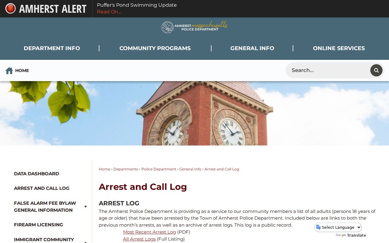
The weekly Amherst Police call log can add a limited layer of street context. It identifies date, event, and street name for non-sensitive calls, but leaves out street numbers. Sensitive victim calls, rape and sexual-assault calls, and child-abuse calls are excluded. The archive also carries adult arrest logs, which should never be treated as a list of current residents or as proof of guilt.
The Amherst Police arrest and call-log page provides the public archive and explains the street-only format.
The missing street number is a deliberate privacy boundary. Use a log for broad, dated street context, not to identify or monitor a specific household.
Amherst Official Versus Paid Records
Official sources and paid commercial compilations answer different questions. A commercial neighbor-lookup category can merge old directories, marketing information, property data, and other public records, yet it can be stale or wrong. It does not replace the Amherst parcel map, a deed image, a local voter-record request, or the custodian’s correction process. Start with the record that matches the question and preserve its date.
| Official Amherst or state record | Paid commercial compilation category | Practical difference |
|---|---|---|
| Parcel map and property card | Compiled property and contact information | Official parcel fields are traceable to Amherst; compiled data may mix dates and sources. |
| Town Clerk local voter-list request | Estimated person or address associations | Local public fields and confidential-voter limits apply; a compilation cannot override them. |
| Hampshire deed image | Summarized ownership history | The recorded image and legal description are the primary title evidence. |
Amherst Neighbor Privacy Limits
A neighbor lookup will never show every person connected with a block. Public property records do not reliably identify every person at an address. Utility customer and delivery-recipient lists were not located as public Amherst data, and RMV address information is protected by the federal Driver’s Privacy Protection Act. The Massachusetts Address Confidentiality Program provides a substitute address and mail forwarding for qualifying survivors and protected health-care providers. Confidential voters are likewise protected in election records.
Massachusetts Public Records Law has privacy and safety exemptions, including protection against an unwarranted invasion of privacy. A requester should not try to reconstruct protected addresses from parcel, voter, or other public records. If a public record seems wrong, contact the office that holds it rather than repeating unverified information.
Lawful use. Amherst neighbor research can support civic awareness, family history, estate questions, reconnecting, or property context. M.G.L. c. 265, §§ 43 and 43A prohibit stalking and harassment, and public records never authorize repeated unwanted contact, intimidation, or harm.