
Amherst Street Directory Route
For an Amherst address, start by fixing the street spelling and house number before interpreting any record. The official Amherst street map supplies street names and address-number orientation. The Town also maintains an Amherst Street History application for name-history clues, although the research inspection received a payment-required response. That limitation matters: a detailed public list of local renumberings was not located, so an old number should be treated as a lead to reconcile, not as a permanent parcel identity.
The street directory works best as a chain. Amherst Maps identifies a parcel and links outward; the Registry documents title transfers; a lawful local election-record request can confirm the fields that are public for a particular record; and historical address sources can test an earlier household. Keep the date beside every result. An owner mailing address is a tax-contact field and may be far from the Amherst parcel.
- Normalize the Amherst street name and number with the official map or GIS search. Record unit letters, spelling variants, and any old or new numbering noted in the source.
- Search Amherst Property Search by street and house number. Save the parcel ID, situs, owner name, assessment, sales, and property-card link.
- Open the Amherst Maps parcel viewer and select the polygon. Compare map, block, lot, PIN, neighboring polygons, and available property-card links.
- Search the owner as grantee in the Hampshire Registry of Deeds, using Amherst and a date near the sale shown on the card. Read the image and legal description.
- For a dated resident question, use the state tool only for an individual self-check, or ask the Amherst Town Clerk about a lawful local voter-record request. Then test past address evidence in a verified directory or census year.
Note: Preserve the source date, search spelling, parcel identifier, and document reference so a later check can distinguish a changed record from an earlier result.
Amherst Street Names and Numbers
Street labels, parcel identifiers, and deed descriptions are related but not interchangeable. Amherst’s public parcel layer carries PIN, MapParID, PID, map, block, lot, location, number, number character, street, owner name, and property-card fields. That makes the GIS record the practical bridge from a familiar address to the parcel language found in a deed. The Registry does not assign street numbers, and the Town’s research did not identify a public page naming a single Amherst E911 address authority.
A comparison can resolve an apparent mismatch. First check the street map. Next, compare street and number with the GIS location fields. Then match the map, block, lot, plan, or legal description in the deed. A parcel may be split, combined, or described through a plan without a current street number. The deed’s legal description controls the land reference, while the map is valuable for showing how that reference fits the modern Amherst street pattern.
- Parcel
- A defined piece of land recorded in Amherst assessment and GIS systems, commonly tied to a parcel ID and map or lot fields.
- Situs address
- The physical location used for the parcel, distinct from the address where tax correspondence is sent.
- Plat or plan
- A recorded map that shows lots, boundaries, roads, or a subdivision. Hampshire Registry plan records can connect older land descriptions to current map evidence.
- Criss-cross directory
- An address-keyed directory format that may point from a number and street to an historical listing. Amherst’s exact local run must be confirmed with the repository.
Amherst Property Search by Street
Amherst Property Search is the first official address route. Its address mode combines a dynamic Street list with a dynamic House # list. If the address route fails, owner mode accepts Last Name and parcel mode accepts Parcel ID. The inspection showed a parcel example of 14A-304. Results link a parcel ID and address to a property card, use description, and recent assessments. The Town says public online property data begins in 2002 and Amherst Maps began in 2006, so older land questions need the Registry and local-history sources as well.
| Amherst field | Input | When to use it | Result or caution |
|---|---|---|---|
| Street | Dynamic dropdown | Address mode | Choose the Amherst street before the house number. |
| House # | Dynamic dropdown | Address mode | Options follow the chosen street; the complete list is dynamic. |
| Last Name | Text | Owner mode | Useful when an address search is incomplete; partial-match guidance was not stated. |
| Parcel ID | Text | Parcel mode | Connects the result to GIS and assessment material. |
| Property tabs | Result links | After a match | May include assessment, sales, permits, violations, documents, and map links. |
The property card can show owner names, situs and mailing addresses, sales, annual assessment, permits, improvements, land and structural data, sketches, and sometimes building photos. It is not a professional survey. Amherst also states that an owner can seek suppression of a public property-card link, so an absent link does not establish that no underlying municipal record exists.
Amherst Maps Along a Street
The public Amherst Maps parcel viewer provides Search, Selection, Legend, Location, Markup, Share, and Print tools. Select a parcel polygon, inspect its popup, and move along the adjoining polygons rather than assuming that nearby street numbers represent one continuous ownership record. The viewer also connects public property information with layers for deeds and plans, streets, cemeteries, school districts, conservation areas, landmarks, and neighboring-community property information.
Amherst’s GIS viewer displays the selection and parcel-detail controls used in a street-by-street check.
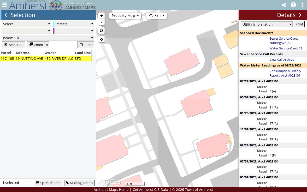
Use the displayed parcel geometry as map context, then follow the property-card or deed references. Amherst cautions that GIS boundaries do not carry legal survey accuracy, and some staff-only layers are not public.
Amherst Address Record Coverage
Address-keyed sources have different strengths. The assessment card provides current parcel context; the deed image supplies the recorded transfer; permits can date physical work; and historical sources can test an earlier name or household. A Massachusetts voter-status search is deliberately an individual self-check, not a street browser. The Amherst Town Clerk can address a properly scoped local request, but confidential records and non-public fields stay withheld.
| Address record | Amherst keeper | Street-level evidence | Access route |
|---|---|---|---|
| Property card | Amherst Assessors | Owner, situs and mailing fields, parcel ID, assessment, sales, permits, and improvements | Online address, owner, or parcel search; phone, email, or counter fallback |
| GIS parcel | Amherst GIS | Polygon, map, block, lot, PIN, street and number fields, map layers | Public viewer and parcel-layer service |
| Recorded land | Hampshire Registry of Deeds | Grantor, grantee, date, book/page, legal description, plan or certificate reference | Free web search and images, plus Registry counter and phone |
| Plans and tax maps | Registry and Amherst GIS | Lot, road, boundary, and parcel-map context | MassLandRecords plan search, map viewer, and Town map PDFs |
| Permits and violations | Inspection Services and Amherst Maps | Address-based construction, alteration, permit, or violation references | Property tabs, monthly reports, office contact, or a narrow records request |
| Local voter record | Amherst Town Clerk | Public fields allowed by law for the record requested | Individual state self-check or local request; protected records withheld |
Parcel ID and map references join the first four sources, while the normal street name joins them for practical searching. Do not treat a permit or deed alone as proof of present occupancy. Each source records a transaction, condition, or status at its own time.
Hampshire Deeds for Amherst Streets
The Hampshire Registry of Deeds makes searching and image viewing free. Recorded Land index entries with linked images reach back to 1874. For documents after January 1, 1928, name, book/page, document number, property, and recorded-date paths are available. Search by the owner’s name and Amherst town filter even when a street address is known, because the Registry warns that a recorded document does not always carry a specific property address.
Read the image, not just the result line. Capture the document type, recorded date, grantor and grantee roles, book and page or document number, legal description, plan reference, and any prior-deed reference. The current deed’s grantor is usually the next person to search as grantee when moving backward. A transfer through death may instead require Hampshire Probate and Family Court records, where a public file may identify estate parties and dates subject to protection rules.
For historical residence questions, a deed points to ownership. A dated address listing needs a separate source. The historical volumes are discussed on the Amherst city directory page, where an available house guide or reverse volume can add period-specific address evidence.
Amherst Street Records Before 1928
The important Amherst break is not the start of image access but the change in indexing. The Registry’s search instructions say Recorded Land images and index records reach 1874, yet books 936 and earlier carry only basic document, book/page, recorded-date, document-type, and party information. Marginal references and street information are absent there. Documents before January 1, 1928 are reached by book and page through Search Criteria, Recorded Land, and Unindexed Property Search.
This is a useful numbers check for an Amherst street directory trail: 1874 marks the online Recorded Land reach, 1928 marks the practical property-search divide, and plans reach to 1800. An empty address search in the early period is therefore not a finding about the parcel. It is a signal to use the name, deed reference, legal description, or plan route. Record the date searched because the Registry notes that beginning coverage can change as data is updated.
Amherst Plans Behind an Address
Plans often solve the old-address problem better than a name search. Hampshire Registry instructions assign Amherst the map index code AMIDX and the assessor-map code AMAS. In the Plans area, use Book (Year) Search, enter the appropriate code, select the result line, and view the image. The same instructions place the 1863 Beers Atlas of Hampshire County at Plan Book 2, Page 172, across 35 pages. Those plan routes can connect a street number to map, lot, road, or boundary context when a deed lacks an address.
Reconcile each plan with the modern Amherst parcel map rather than declaring the two identical. Road shifts, parcel splits, combinations, and changes in numbering can break a direct match. The Registry’s Registered Land images are indexed back to 1903, and its Registered Land plans reach 1899, giving a separate route when the parcel is within that land class.
Note: A legal description or plan reference is the safer bridge across time than a street number copied from an old document.
Amherst Address Timing Records
Amherst Property Search links sales, permits, violations, scanned documents, and map material from a result where available. Those dates can help explain why a parcel card changed or when an addition appears in a later record. Amherst Inspection Services administers state building law and local bylaws, posts permit applications and monthly permit reports, and provides an office channel when a property tab does not answer the question.
The Town’s separate real-estate tax portal accepts either parcel ID or address, not both. It asks for house number and street name or an unhyphenated parcel ID, such as 12A345678, and recognizes street abbreviations including ST, AVE, and RD. It is a tax-payment and parcel route, not a full ownership-history system. The assessment card and recorded instrument should be compared instead of substituting one for the other.
The official Town tax-search screen uses the alternate address and parcel-ID route that can help resolve an Amherst street-directory search when one form mode is incomplete.
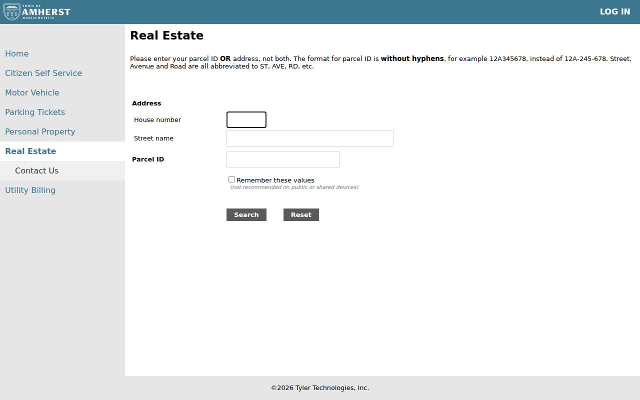
Copy only the stable parcel reference from the result, then return to Amherst Maps and the Registry for the fuller address and title trail.
Amherst Voter Limits by Street
Massachusetts separates individual status verification from a public street roster. The Secretary’s Find my voter registration status tool requires first name, last name, date of birth, five-digit residential ZIP, acknowledgement, and submission. It is designed for an individual checking their own status and cannot browse a street. The statewide central voter registry is not a public record under the Secretary’s guidance.
Local records follow a different path. The Secretary says local public voter fields can include name, residential address, party, date of birth, status, voter ID, participation history, mailing address, registration date, and related record-change dates. Phone, email, veteran status, permanent absentee status, confidential records, and minor preregistration information are among the withheld examples. A request to the Amherst Town Clerk should identify the desired date, list type, format, and precinct or district scope, then ask about current production cost.
Amherst Historical Street Clues
When current parcel data ends, historical address sources can provide an earlier snapshot, but only for a confirmed year and collection. Jones Library holds tax records from the mid-eighteenth century, newspapers from 1786, census material, maps, manuscripts, and local-history collections. Its Boltwood Local History and Genealogy Collection is an offline research channel when an address source is not digitized. Ask whether the requested year has an address, house-guide, or reverse directory before relying on it.
The Library of Congress explains that city, street-address, telephone, and criss-cross access are separate directory formats. A later criss-cross volume may be useful by address, yet it should not be assumed for every Amherst year. The Library of Congress directory guide, Jones, the Amherst Historical Society, and the Massachusetts State Library are the appropriate places to verify a specific volume. A blank year is a collection gap, not evidence that an address had no household.
Amherst Address-Search Boundaries
A street search has firm limits. Property records identify an ownership interest and tax-contact fields, not every person at an address. RMV address data is protected under the Driver’s Privacy Protection Act. Utility customer and delivery-route lists were not located as public Amherst data. Weekly police call logs show a street name but omit the street number and sensitive events, which supplies general street context without identifying a particular household.
Use an Amherst street directory for family history, estate questions, title research, consumer-scam verification, or civic property curiosity. Do not infer a current resident from a mailing address, an old directory line, a permit, or a deed. Confidential voter records and Massachusetts Address Confidentiality Program participants remain protected, as do other restricted record categories.
Lawful personal use. Amherst address records may support personal, historical, estate, and civic research. Using information to stalk, harass, or intimidate another person is unlawful; Massachusetts anti-stalking law is M.G.L. c. 265, § 43.